Lake Lanier Sailing Routes: What You See From Captain John's Boat
Most people ask me the same thing the moment they step aboard at Aqualand Marina, Dock Zk: what are we actually going to see out there? This guide walks the standard Lake Lanier sailing routes landmarks that every charter passes, from Buford Dam at the lake's south end up toward Browns Bridge and the long water beyond. Twenty plus years on this lake, and I still point at the same places every trip because they earn it.
Lake Lanier sailing routes landmarks you see in the first hour
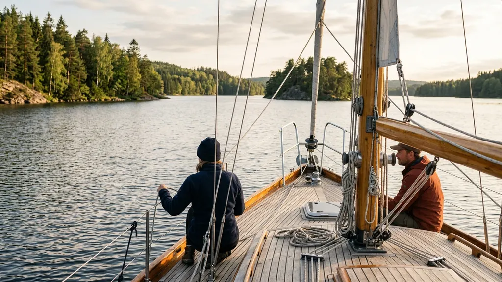
The first hour out of Aqualand Marina covers the most photographed Lake Lanier sailing routes landmarks: the open water south of Bald Ridge, the Buford Dam approach to your east, and the green slopes around Little Hall Park. The dam sits roughly 2.0 nautical miles from Dock Zk, which puts it in view within the first 20 to 30 minutes on any breeze over 6 knots. Most first-time guests do not realize how close the structure actually sits to the marina until we round the point; our guide for first-timers covers what to expect on that first approach.
From Dock Zk we head southeast and the wind usually fills in over the open shoulder once we clear the marina breakwater. On a typical afternoon the dam wall rises gray and low against the treeline. The USACE recreation overview calls the dam the defining structure of the impoundment, and from a sailboat you understand why: every wind line on the lake reads off that south wall.
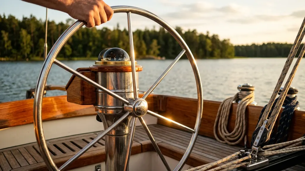
We point past Bald Ridge toward the channel marker line that the U.S. Coast Guard Auxiliary tracks in its boating safety overviews. Traffic is thinner on weekday afternoons. You will see pontoon boats hugging the shoreline, the occasional ski boat carving the chop, and most days a handful of other sailboats from the Lake Lanier Sailing Club fleet. Captain John holds a U.S. Coast Guard Captain's license and has owned Lord Nelson Charters out of Aqualand Marina since 2003, building more than two decades of direct knowledge about which waypoints deliver reliably and which depend on conditions.
For a closer look at this, see Engagement Photo Shoot on a Lake Lanier Sailboat: What to Plan.
For a closer look at this, see Sailboat proposal on Lake Lanier: a step-by-step guide for 2026.
For a closer look at this, see Corporate team building Lake Lanier: a leadership offsite case study.
For a closer look at this, see Birthday boat party Lake Lanier: book the full boat for 14 guests.
For a closer look at this, see Beginner sailing lessons on Lake Lanier: what you need to know.
For a closer look at this, see Lake Lanier sunset cruise: Atlanta's favorite anniversary tradition.
For a closer look at this, see What to bring on a sailing charter: your Lake Lanier gear list.
For a closer look at this, see Lake Lanier Sailing Charter for Families: What to Know Before Booking.
For a closer look at this, see Bachelorette party boat Lake Lanier: the complete planning guide.
For a closer look at this, see Sailing lessons Lake Lanier: What Captain John teaches beginners.
For a closer look at this, see Sailing Day Trip from Atlanta: Your Lake Lanier 40-Minute Guide.
There is a full breakdown of this topic in Your first time on a sailboat what to expect: a Lake Lanier guide.
There is a full breakdown of this topic in Sailboat Proposal on Lake Lanier: How Couples Plan the Big Moment.
Buford Dam and Lake Lanier sailing routes landmarks geography
Buford Dam defines the geography of the Lake Lanier sailing routes landmarks because it created the lake itself. The U.S. Army Corps of Engineers completed the dam in 1957, impounding the Chattahoochee River and flooding 38,000 surface acres across Hall, Forsyth, Gwinnett, and Dawson counties. The shape you sail today is the old river valley: the deep main channel runs north out of the dam following the Chattahoochee streambed past Browns Bridge, and every side cove is a flooded creek arm, which is why some stay quiet even on busy summer Saturdays. The municipal water intake that serves over four million metro Atlanta residents sits near the south end, monitored closely by the Chattahoochee Riverkeeper. The dam is off-limits to boat traffic above its structure; the U.S. Army Corps of Engineers maintains a floating buoy line where all recreational boats, including sailboats, must stop. From that line you still have a clear view of the spillway, the powerhouse roofline, and the gray rip-rap face. Current restricted-area notices are posted on the USACE Mobile District Lake Sidney Lanier page. The Lake Lanier Association publishes a useful geography primer for new boaters.
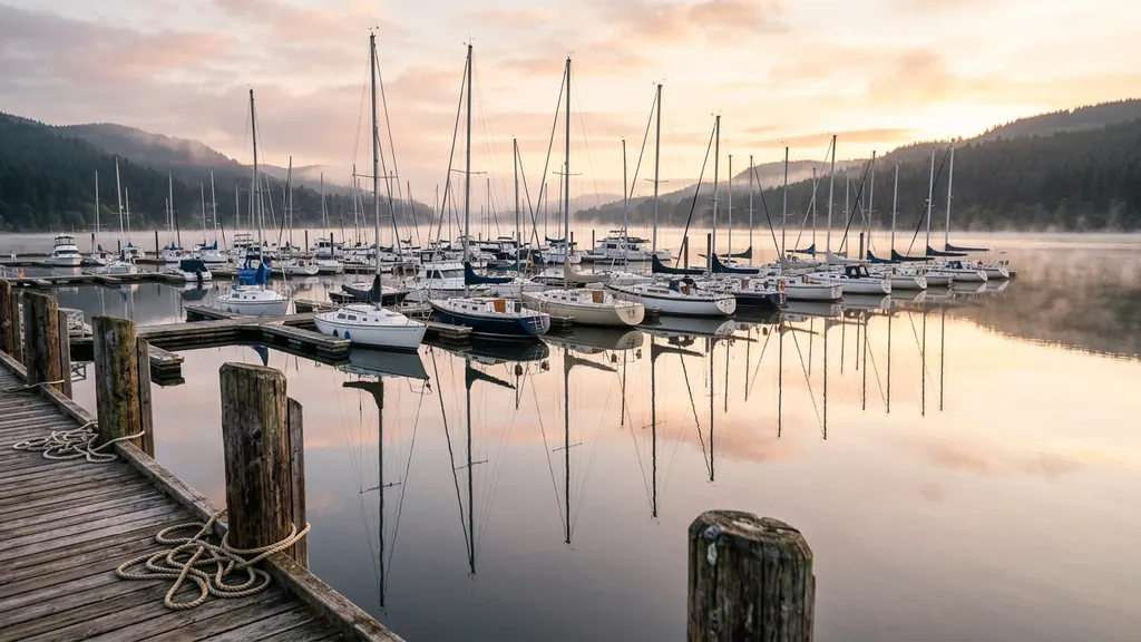
Aqualand Marina coves on shorter Lake Lanier sailing routes landmarks tours
For a shorter sail or a windy day, the Lake Lanier sailing routes landmarks closest to Aqualand Marina give you sheltered water within a half-mile of the dock. The flooded creek arms near Flowery Branch run north-south and hold less than a foot of chop in south winds up to 12 knots, while the wooded ridges cut the swell before it can build on the open lake.
Flowery Branch Creek itself is the obvious first option. The cove west of Holiday Marina holds a steady surface in most wind angles. We use it for first-time sailors who want to feel the boat heel a little without 2-foot chop. Aqualand's own breakwater extends further than people realize, and the City of Flowery Branch publishes the local shoreline map that shows the creek mouth clearly.
Just north of the marina, Mud Creek and Four Mile Creek open into protected pockets that hold less than a foot of chop in 12-knot winds. Reading the forecasts on the National Weather Service Atlanta office page before a sail tells you when the south wind is going to make the open lake bumpy and these coves are the better call.
If you are deciding between a half-day sail that mostly works these inner waters and a full-day that pushes north, our breakdown in half-day vs full-day sailing charter on Lake Lanier walks through the trade-offs.
Chattahoochee inflow shapes wind and current along these waters
Summer thermals on this stretch of the lake build to 6 to 12 knots by midday on most clear days, driven by the Chattahoochee River inflow at the north end and the valley geometry that channels south Piedmont air northward. The river drops cold above Lula and pushes south through the long arm of the lake, meeting the downvalley flow to create the variable breeze that shapes the Lake Lanier sailing routes landmarks day for every charter. What that means in practice: the breeze you sail in at Aqualand is often a thermal that has been bent by the river valley geometry. The NOAA regional forecast products and the local NWS Atlanta office both flag a southerly daytime sea-breeze effect from the warmer Piedmont, and on the lake that meets the cooler downvalley flow from the north arm and gives you the swirly midlake conditions a lot of new sailors find confusing.
Current matters less than wind on most days, but during heavy USACE releases through Buford Dam you will feel a measurable pull near the south end. The U.S. Army Corps of Engineers publishes the daily release schedule. I check it before any sail that will sit in the dam approach zone.
August 2024, midmorning start, we were three miles into the dam approach when the thermals shut off completely. Wind dropped from 10 knots to zero in twenty minutes. I gave the guests two options: motor back and refund the sail time, or run east into Flowery Branch Creek where a small breeze was holding. We took the creek. They ended up closer to a heron rookery than any dam photo would have given them, and they left satisfied. That is the honest truth about this lake: the route you planned is not always the route that pays off.
Browns Bridge and Two Mile Creek on longer sails up the lake
The Browns Bridge corridor stretches from 3.5 to 5.2 nautical miles north of Aqualand Marina and holds the Lake Lanier sailing routes landmarks that reward a full-day booking. GA-369 crosses at the 3.5-mile mark; above it the water runs wide, powerboat traffic drops sharply, and the valley gives the wind a clean shot that produces long, open tacks with room to breathe on both sides.
Two Mile Creek opens into a wide arm with steady wind and far fewer powerboats than the southern end. The cove sides give you a wind shadow if a squall builds. Browns Bridge itself, carrying GA-369 across the lake, is visible from miles south and gives the corridor its name. Sailing under it on a north tack is one of the small rituals of a full-day trip.
| Landmark | NM from Aqualand | Reachable on half-day | Best on full-day |
|---|---|---|---|
| Buford Dam approach | 2.0 | Yes | Yes |
| Two Mile Creek mouth | 1.2 | Yes | Yes |
| Browns Bridge | 3.5 | Tight | Yes |
| North main body | 5.2 | No | Yes |
For first-time visitors driving up from the city, our Atlanta to Lake Lanier day trip planning guide covers the I-985 corridor approach and parking at the marina. If you want a sense of which months reward the longer northern routes, the best time to sail Lake Lanier primer breaks it down by season. The Georgia Department of Natural Resources publishes boating safety requirements applicable to all vessels on Lake Lanier, which is useful reading before any extended sail.
Frequently asked questions
What are the main Lake Lanier sailing routes landmarks on a 2.5-hour charter?
On a 2.5-hour charter departing Aqualand Marina Dock Zk, the main Lake Lanier sailing routes landmarks you will see are the Buford Dam approach to the southeast, the Bald Ridge shoreline, the entrance of Two Mile Creek to the north, and the protected coves of the Flowery Branch arm. Depending on wind we may run up toward the Browns Bridge sightline but rarely sail under it on the shorter trip. The USACE Lake Sidney Lanier page shows the official lake map for reference.
How close to Buford Dam can a sailboat actually get?
The U.S. Army Corps of Engineers maintains a restricted area around Buford Dam that is marked with floating buoys. Recreational boats including sailboats stay outside that buoy line at all times. From the buoy line you are roughly a quarter mile off the structure, which is plenty close for photos and easy to see the spillway, the powerhouse roofline, and the gray rip-rap face. The USACE publishes the restricted-area dimensions and we treat them as fixed.
Do longer Lake Lanier sailing routes landmarks tours actually need a full day?
Yes, if you want Browns Bridge and the north main body, plan the full-day. The wider Lake Lanier sailing routes landmarks above Two Mile Creek are roughly five nautical miles from Aqualand Marina, which means at typical sailing speeds you spend close to 90 minutes one way, and that does not leave time on a half-day to actually enjoy them. Half-day trips stay south and still cover Buford Dam plus the sheltered coves, which is scenic sailing country and the right call for most first-timers.
What is the wind like out of Aqualand Marina in summer?
Summer afternoon winds at Aqualand Marina typically run from the south or southwest at 6 to 12 knots, building after 1pm as the metro Atlanta thermal pulls air northward up the valley. Calm mornings are common, which is why most charters launch around midday. The National Weather Service Atlanta forecast office is the most reliable source. We also watch the NWS marine and inland forecasts the morning of every sail and call off if a squall line is tracking through.
Can families with young children handle these routes comfortably?
Yes. The sheltered coves near Aqualand Marina and the slow run to the Buford Dam approach are comfortable for children who have never been on a sailboat. We carry USCG-approved child life jackets in infant, child, and youth sizes, keep heel angle under 10 degrees unless guests ask for more, and route away from choppy water on family trips. Our youngest guests have been 18 months old. The U.S. Coast Guard boating safety resources have life-jacket-sizing guidance that I check before every trip with children aboard.
Where can I learn more about Lake Lanier itself before a sail?
The most useful pre-trip reading is the Lake Lanier Association overview for visitor orientation (they cover boating rules, ramp locations, and seasonal events), the Georgia DNR Wildlife Resources Division page on lake fish populations and habitat, and the US Sailing knowledge library if you want to brush up on points of sail and right-of-way rules before boarding. Twenty minutes with any of those three will let you ask sharper questions on the water and pick up the boat faster than starting cold.
For a closer look at this, see Bachelorette party boat Lake Lanier: how to plan the perfect sail.
We cover the details separately in Wednesday group sail Lake Lanier: the $79 per-seat format explained.
For a closer look at this, see Lake Lanier pirate cruise kids: plan the perfect family sail.